GreenValley LiDAR360
GreenValley LiDAR360: Professional LiDAR Point Cloud Processing For Multi-Industry Analysis
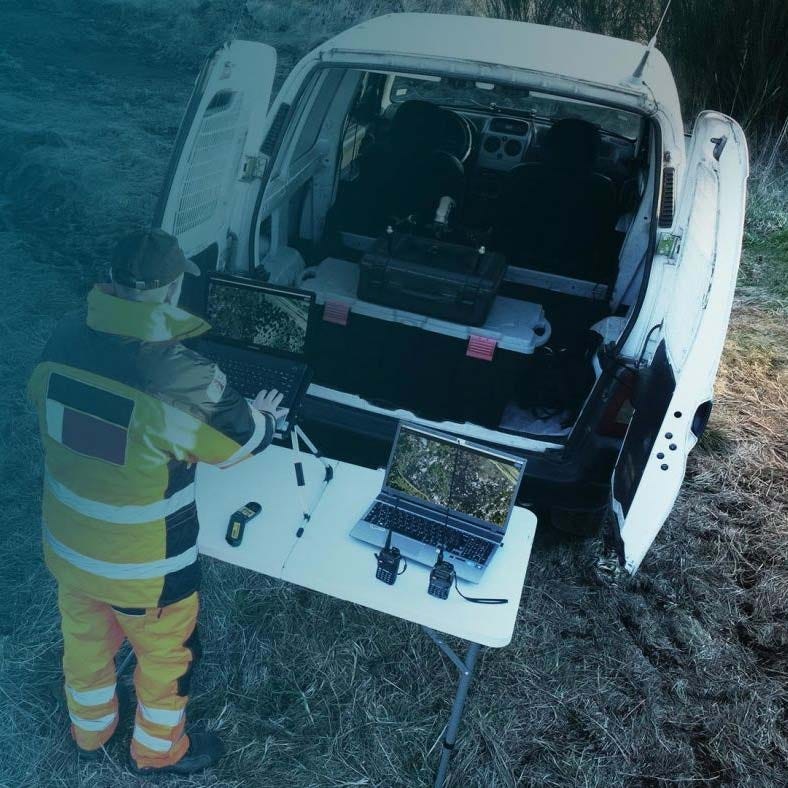
GreenValley LiDAR360 is a professional LiDAR point cloud processing and analysis platform built for airborne, mobile, UAV, and SLAM/handheld datasets. It supports TB-scale visualization, classification, modeling, and measurement workflows across surveying, forestry, powerline inspection, mining, geology, and digital twin applications.
With more than 700 tools, one-click processing workflows, multi-source data integration, and CPU/GPU high-performance computing, LiDAR360 helps organizations convert large LiDAR datasets into actionable deliverables for mapping, inspection, modeling, and asset analysis.
GreenValley LiDAR360 Core Features And Multi-Industry Processing Capabilities
- TB-scale processing platform: visualize and analyze large LiDAR datasets efficiently.
- Multi-source data support: combine Airborne, Mobile, and SLAM/Handheld data with imagery and raster products.
- AI classification engine: classify ground, buildings, vegetation, and other features.
- Accuracy optimization tools: correct boresight, trajectory, and elevation discrepancies.
- Distributed computing support: scale workflows across multiple connected processing nodes.
- Terrain production tools: generate DEM, DSM, contour, slope, and flood outputs.
- Forestry analysis functions: segment trees and calculate structural forest attributes.
- Powerline inspection workflows: classify towers and detect corridor clearance hazards.
- Vector editing environment: integrate CAD and GIS data with point clouds.
- Digital twin modeling tools: support large-scale building extraction and texture workflows.
GreenValley LiDAR360 is designed as a one-stop LiDAR processing environment for organizations working across multiple geospatial and inspection disciplines. Its broad toolset supports everything from point cloud cleanup and classification to terrain generation, feature extraction, and industry-specific analysis. By combining scale, automation, and specialized modules, LiDAR360 helps teams standardize complex LiDAR workflows within a single software platform.
When you purchase GreenValley LiDAR360 from DSLRPros, you receive authorized software licensing from a UAS solutions provider that understands professional LiDAR workflows. We help align platform selection, licensing structure, and module planning with your operational requirements.
Purchase GreenValley LiDAR360 from DSLRPros to support advanced LiDAR data processing across your mapping and inspection programs.
Original: $1,300.00
-70%$1,300.00
$390.00Product Information
Product Information
Shipping & Returns
Shipping & Returns
Description
GreenValley LiDAR360: Professional LiDAR Point Cloud Processing For Multi-Industry Analysis
GreenValley LiDAR360 is a professional LiDAR point cloud processing and analysis platform built for airborne, mobile, UAV, and SLAM/handheld datasets. It supports TB-scale visualization, classification, modeling, and measurement workflows across surveying, forestry, powerline inspection, mining, geology, and digital twin applications.
With more than 700 tools, one-click processing workflows, multi-source data integration, and CPU/GPU high-performance computing, LiDAR360 helps organizations convert large LiDAR datasets into actionable deliverables for mapping, inspection, modeling, and asset analysis.
GreenValley LiDAR360 Core Features And Multi-Industry Processing Capabilities
- TB-scale processing platform: visualize and analyze large LiDAR datasets efficiently.
- Multi-source data support: combine Airborne, Mobile, and SLAM/Handheld data with imagery and raster products.
- AI classification engine: classify ground, buildings, vegetation, and other features.
- Accuracy optimization tools: correct boresight, trajectory, and elevation discrepancies.
- Distributed computing support: scale workflows across multiple connected processing nodes.
- Terrain production tools: generate DEM, DSM, contour, slope, and flood outputs.
- Forestry analysis functions: segment trees and calculate structural forest attributes.
- Powerline inspection workflows: classify towers and detect corridor clearance hazards.
- Vector editing environment: integrate CAD and GIS data with point clouds.
- Digital twin modeling tools: support large-scale building extraction and texture workflows.
GreenValley LiDAR360 is designed as a one-stop LiDAR processing environment for organizations working across multiple geospatial and inspection disciplines. Its broad toolset supports everything from point cloud cleanup and classification to terrain generation, feature extraction, and industry-specific analysis. By combining scale, automation, and specialized modules, LiDAR360 helps teams standardize complex LiDAR workflows within a single software platform.
When you purchase GreenValley LiDAR360 from DSLRPros, you receive authorized software licensing from a UAS solutions provider that understands professional LiDAR workflows. We help align platform selection, licensing structure, and module planning with your operational requirements.
Purchase GreenValley LiDAR360 from DSLRPros to support advanced LiDAR data processing across your mapping and inspection programs.