MicaSense RedEdge-P Multispectral Camera Kit with DJI Skyport M300 / M350
MicaSense RedEdge-P with DJI SkyPort Kit: Modular multispectral imaging with direct DJI SkyPort integration
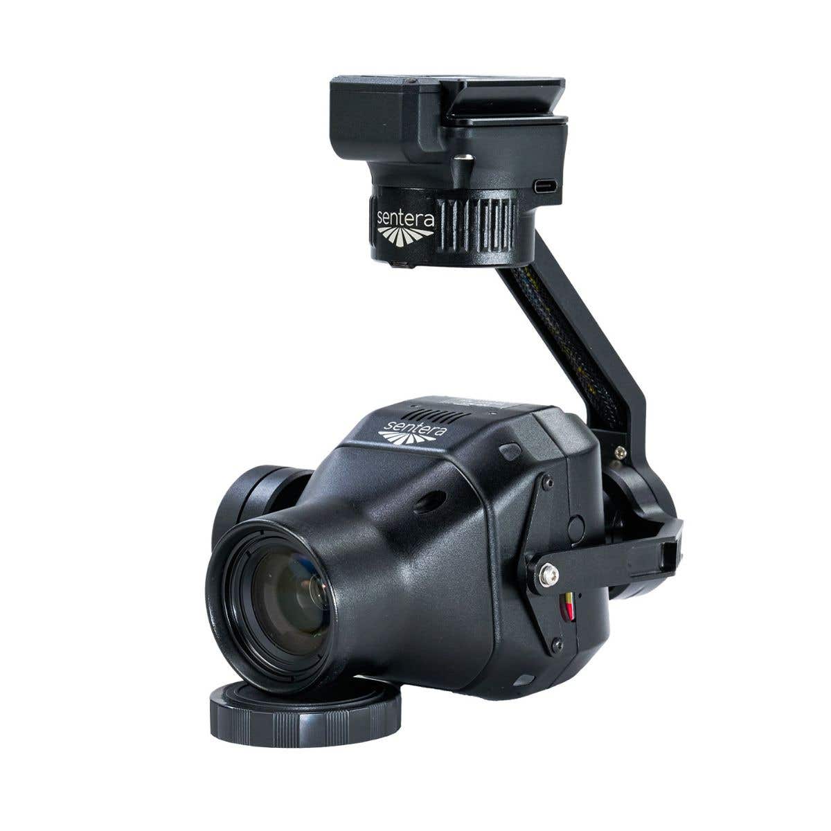
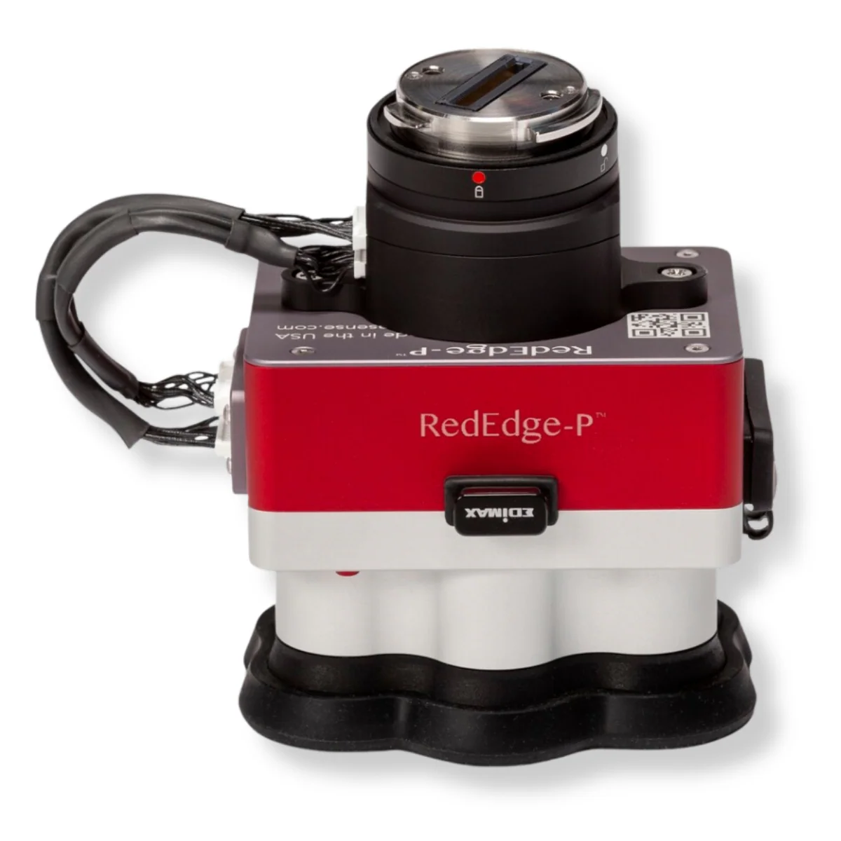
The MicaSense RedEdge-P with DJI SkyPort Kit is a complete multispectral imaging bundle designed for professional UAV operations using DJI Matrice 300 RTK and Matrice 350 RTK aircraft. This bundle combines the RedEdge-P modular multispectral camera system with a dedicated DJI SkyPort adapter, enabling secure, direct mounting without custom integration.
Designed for repeatable data capture, RedEdge-P delivers narrowband multispectral, panchromatic, and RGB imagery with reliable radiometric calibration, supporting precision agriculture, environmental monitoring, and research programs that depend on consistent, time-series datasets.
Modular multispectral and panchromatic sensing architecture
- Multispectral resolution: 1456 × 1088 pixels, 1.6 MP per band
- Panchromatic resolution: 2464 × 2056 pixels, 5.1 MP output
- RGB channel: 5.1 MP global shutter, spatially aligned
- Five-band base system: Blue, Green, Red, Red Edge, Near-IR
- Modular expansion: Pair compatible units for up to ten bands
- Narrow spectral bandwidths: Optimized for vegetation analysis accuracy
- Synchronized capture: All spectral bands captured simultaneously
- CFexpress storage: Supports high-speed, high-volume data collection
Consistent spatial resolution for repeatable analysis
RedEdge-P balances spectral fidelity with efficient spatial coverage for large-area surveys. At 120 m (400 ft) AGL, multispectral imagery achieves approximately 7.7 cm per pixel ground sampling distance, while the panchromatic channel reaches approximately 3.98 cm per pixel.
With appropriate post-processing, pan-sharpened outputs can approach 2 cm per pixel resolution. This consistency supports accurate vegetation classification, weed detection, and spatial change analysis while maintaining efficient coverage for agricultural and environmental monitoring programs.
Radiometric calibration for time-series accuracy
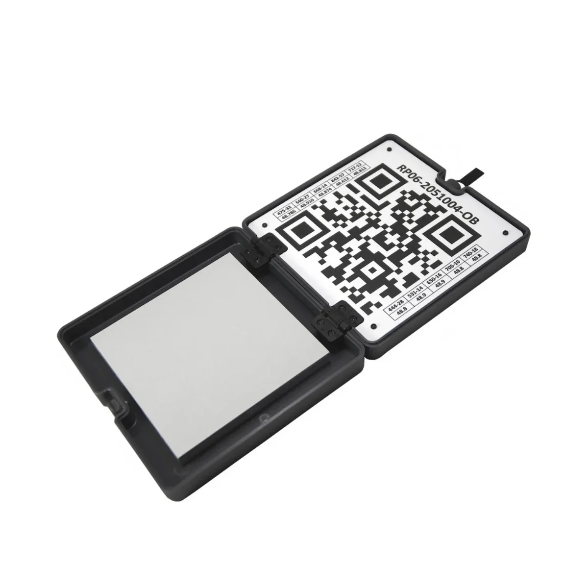
Radiometric consistency is central to the RedEdge-P design. The system supports double radiometric calibration using the integrated Downwelling Light Sensor 2 (DLS 2) and calibration reflectance panels. This approach enables normalization of imagery captured under varying illumination conditions, improving comparability across dates and seasons.
By reducing the impact of changing sunlight and atmospheric variability, RedEdge-P supports reliable time-series analysis for precision agriculture, machine learning workflows, and long-term environmental research programs.
Aircraft compatibility and SkyPort-based integration
- DJI Matrice 300 RTK: Fully supported via included SkyPort Kit
- DJI Matrice 350 RTK: Fully supported via included SkyPort Kit
- DJI Matrice 400 RTK: Not supported at this time
- Direct SkyPort interface: Mechanical and electrical aircraft integration
- Secure mounting: Maintains stable sensor alignment during flight
- Simplified installation: Eliminates custom mounts and wiring
Professional applications supported by the bundle
- Crop health monitoring: Analyze vegetation indices to identify stress patterns early.
- Weed identification: Detect weed pressure zones using narrowband multispectral imagery.
- Time-series crop analytics: Track seasonal change using radiometrically consistent datasets.
- Machine learning training data: Capture repeatable spectral inputs for model development.
- Habitat monitoring and restoration: Assess vegetation condition to guide conservation planning.
- Coastal and shallow-water mapping: Monitor sensitive environments with multispectral sensitivity.
- Water resource management: Evaluate vegetation response near irrigation and watershed systems.
- Digital plant phenotyping: Quantify growth-stage traits using repeatable spectral measurements.
Altum-PT vs RedEdge-P (Key Comparison)
| Category | Altum-PT | RedEdge-P |
|---|---|---|
| Primary purpose | Combined multispectral, thermal, and RGB sensing | High-resolution multispectral and RGB imaging |
| Thermal imaging | Yes – radiometric FLIR LWIR (320 × 256) | No thermal sensor |
| Multispectral bands | 5 bands (Blue, Green, Red, Red Edge, NIR) | 5 bands per sensor; up to 10 bands with dual-camera setup |
| RGB / panchromatic sensor | 12 MP panchromatic | 5.1 MP panchromatic (pan-sharpened) |
| Multispectral GSD @120 m | 5.28 cm per pixel | 7.7 cm per pixel |
| Pan-sharpened resolution | 2.49 cm per pixel @120 m (≈1.25 cm @60 m) | ≈3.98 cm per pixel @120 m (≈2 cm with pan-sharpening) |
| Thermal GSD @120 m | 33.5 cm per pixel | N/A |
| Capture rate | Up to 2 images per second (all bands, RAW) | Up to 3 images per second (RAW) |
| Storage | CFexpress card | CFexpress card |
| Radiometric calibration | Integrated multispectral and thermal calibration | Multispectral calibration with dual calibration panels |
| Typical system weight | ≈577 g | ≈745 g (dual-sensor configuration) |
| Best-fit use cases | Irrigation diagnostics, water stress, soil moisture, thermal crop analysis | Vegetation indices, crop vigor, classification, time-series analysis |
Choose Altum-PT if your workflow requires thermal data alongside multispectral imagery, such as irrigation optimization, water stress detection, or soil moisture analysis. Choose RedEdge-P if your priority is higher spectral flexibility, faster capture rates, and advanced vegetation indices for crop monitoring, classification, and long-term time-series analysis.
Designed for enterprise integration and long-term programs
The RedEdge-P with SkyPort Kit is engineered for enterprise UAV programs requiring scalability, repeatability, and dependable integration. The included SkyPort adapter provides secure mounting on supported DJI platforms, while defined electrical interfaces support consistent operation across fleets.
An IP4X environmental rating and specified operating temperature ranges support field deployment in diverse conditions. Together, the sensor and SkyPort Kit form a deployment-ready solution for organizations conducting long-term agricultural, environmental, and research monitoring initiatives.
The MicaSense RedEdge-P with DJI SkyPort Kit delivers a modular multispectral solution for professionals who prioritize spectral accuracy and repeatable results.
Available from DSLRPros, backed by enterprise UAS specialists who support integration, deployment, and long-term program success.
Original: $10,290.00
-70%$10,290.00
$3,087.00Product Information
Product Information
Shipping & Returns
Shipping & Returns
Description
MicaSense RedEdge-P with DJI SkyPort Kit: Modular multispectral imaging with direct DJI SkyPort integration
The MicaSense RedEdge-P with DJI SkyPort Kit is a complete multispectral imaging bundle designed for professional UAV operations using DJI Matrice 300 RTK and Matrice 350 RTK aircraft. This bundle combines the RedEdge-P modular multispectral camera system with a dedicated DJI SkyPort adapter, enabling secure, direct mounting without custom integration.
Designed for repeatable data capture, RedEdge-P delivers narrowband multispectral, panchromatic, and RGB imagery with reliable radiometric calibration, supporting precision agriculture, environmental monitoring, and research programs that depend on consistent, time-series datasets.
Modular multispectral and panchromatic sensing architecture
- Multispectral resolution: 1456 × 1088 pixels, 1.6 MP per band
- Panchromatic resolution: 2464 × 2056 pixels, 5.1 MP output
- RGB channel: 5.1 MP global shutter, spatially aligned
- Five-band base system: Blue, Green, Red, Red Edge, Near-IR
- Modular expansion: Pair compatible units for up to ten bands
- Narrow spectral bandwidths: Optimized for vegetation analysis accuracy
- Synchronized capture: All spectral bands captured simultaneously
- CFexpress storage: Supports high-speed, high-volume data collection
Consistent spatial resolution for repeatable analysis
RedEdge-P balances spectral fidelity with efficient spatial coverage for large-area surveys. At 120 m (400 ft) AGL, multispectral imagery achieves approximately 7.7 cm per pixel ground sampling distance, while the panchromatic channel reaches approximately 3.98 cm per pixel.
With appropriate post-processing, pan-sharpened outputs can approach 2 cm per pixel resolution. This consistency supports accurate vegetation classification, weed detection, and spatial change analysis while maintaining efficient coverage for agricultural and environmental monitoring programs.
Radiometric calibration for time-series accuracy
Radiometric consistency is central to the RedEdge-P design. The system supports double radiometric calibration using the integrated Downwelling Light Sensor 2 (DLS 2) and calibration reflectance panels. This approach enables normalization of imagery captured under varying illumination conditions, improving comparability across dates and seasons.
By reducing the impact of changing sunlight and atmospheric variability, RedEdge-P supports reliable time-series analysis for precision agriculture, machine learning workflows, and long-term environmental research programs.
Aircraft compatibility and SkyPort-based integration
- DJI Matrice 300 RTK: Fully supported via included SkyPort Kit
- DJI Matrice 350 RTK: Fully supported via included SkyPort Kit
- DJI Matrice 400 RTK: Not supported at this time
- Direct SkyPort interface: Mechanical and electrical aircraft integration
- Secure mounting: Maintains stable sensor alignment during flight
- Simplified installation: Eliminates custom mounts and wiring
Professional applications supported by the bundle
- Crop health monitoring: Analyze vegetation indices to identify stress patterns early.
- Weed identification: Detect weed pressure zones using narrowband multispectral imagery.
- Time-series crop analytics: Track seasonal change using radiometrically consistent datasets.
- Machine learning training data: Capture repeatable spectral inputs for model development.
- Habitat monitoring and restoration: Assess vegetation condition to guide conservation planning.
- Coastal and shallow-water mapping: Monitor sensitive environments with multispectral sensitivity.
- Water resource management: Evaluate vegetation response near irrigation and watershed systems.
- Digital plant phenotyping: Quantify growth-stage traits using repeatable spectral measurements.
Altum-PT vs RedEdge-P (Key Comparison)
| Category | Altum-PT | RedEdge-P |
|---|---|---|
| Primary purpose | Combined multispectral, thermal, and RGB sensing | High-resolution multispectral and RGB imaging |
| Thermal imaging | Yes – radiometric FLIR LWIR (320 × 256) | No thermal sensor |
| Multispectral bands | 5 bands (Blue, Green, Red, Red Edge, NIR) | 5 bands per sensor; up to 10 bands with dual-camera setup |
| RGB / panchromatic sensor | 12 MP panchromatic | 5.1 MP panchromatic (pan-sharpened) |
| Multispectral GSD @120 m | 5.28 cm per pixel | 7.7 cm per pixel |
| Pan-sharpened resolution | 2.49 cm per pixel @120 m (≈1.25 cm @60 m) | ≈3.98 cm per pixel @120 m (≈2 cm with pan-sharpening) |
| Thermal GSD @120 m | 33.5 cm per pixel | N/A |
| Capture rate | Up to 2 images per second (all bands, RAW) | Up to 3 images per second (RAW) |
| Storage | CFexpress card | CFexpress card |
| Radiometric calibration | Integrated multispectral and thermal calibration | Multispectral calibration with dual calibration panels |
| Typical system weight | ≈577 g | ≈745 g (dual-sensor configuration) |
| Best-fit use cases | Irrigation diagnostics, water stress, soil moisture, thermal crop analysis | Vegetation indices, crop vigor, classification, time-series analysis |
Choose Altum-PT if your workflow requires thermal data alongside multispectral imagery, such as irrigation optimization, water stress detection, or soil moisture analysis. Choose RedEdge-P if your priority is higher spectral flexibility, faster capture rates, and advanced vegetation indices for crop monitoring, classification, and long-term time-series analysis.
Designed for enterprise integration and long-term programs
The RedEdge-P with SkyPort Kit is engineered for enterprise UAV programs requiring scalability, repeatability, and dependable integration. The included SkyPort adapter provides secure mounting on supported DJI platforms, while defined electrical interfaces support consistent operation across fleets.
An IP4X environmental rating and specified operating temperature ranges support field deployment in diverse conditions. Together, the sensor and SkyPort Kit form a deployment-ready solution for organizations conducting long-term agricultural, environmental, and research monitoring initiatives.
The MicaSense RedEdge-P with DJI SkyPort Kit delivers a modular multispectral solution for professionals who prioritize spectral accuracy and repeatable results.
Available from DSLRPros, backed by enterprise UAS specialists who support integration, deployment, and long-term program success.